Fallout in numbers, plus what is your home’s Flood Risk?
Information on Council’s current Floodplain Risk Management Studies and Plans is available for free on the NSW SES website
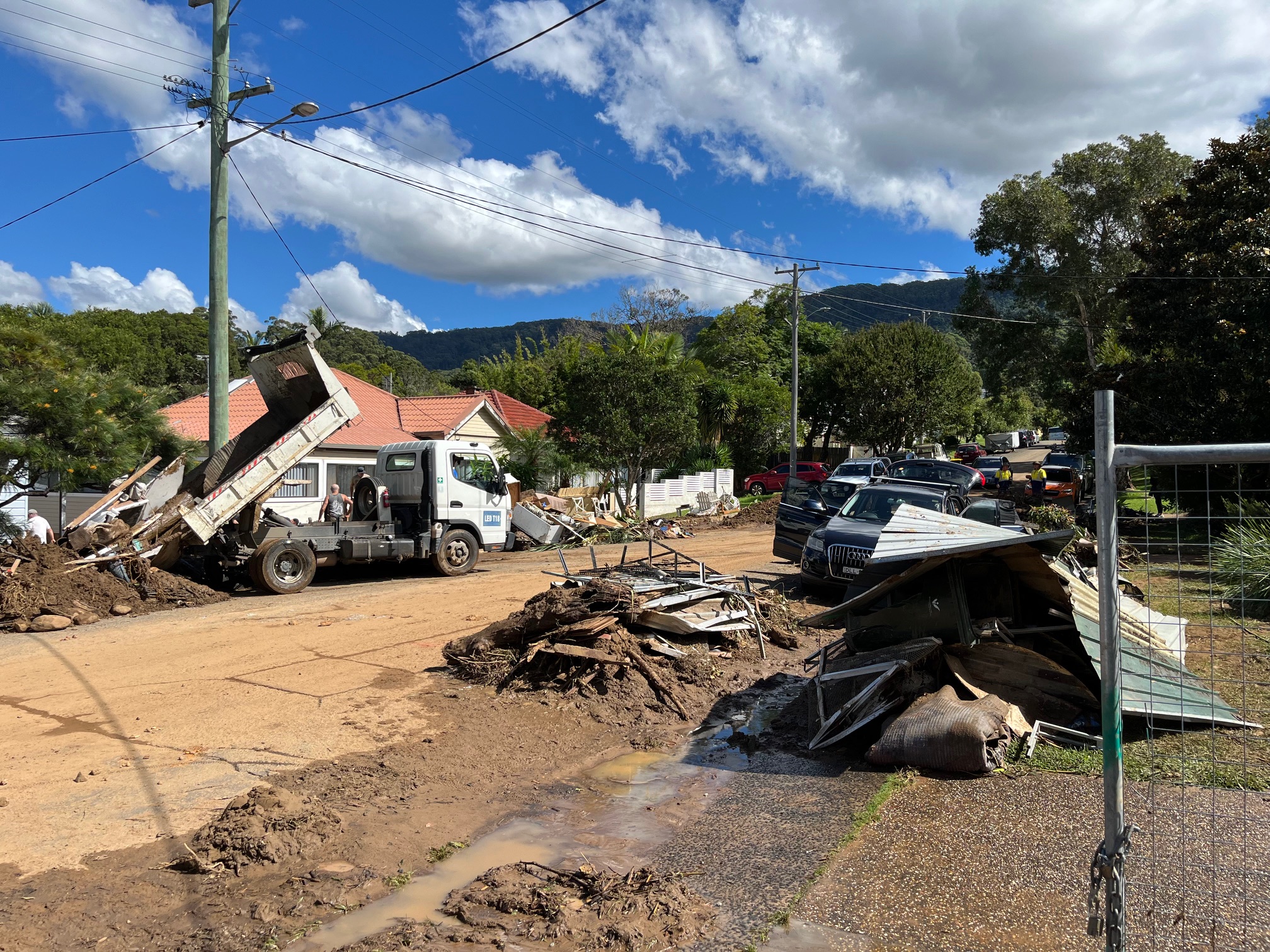
- 200+mm On April 6, the Bureau of Meteorology reported damaging winds and widespread heavy rainfall overnight, with the heaviest totals in the Illawarra at Brogers Creek (272mm), Wattamolla (257mm) and Mount Pleasant (240mm). On April 6 alone, Bellambi recorded 194.8mm.
- 3 Recovery Assistance Points (RAP) in Thirroul, Warrawong and Dapto with staff from Insurance Council of Australia, Service NSW, Red Cross and Salvos. Therapy dogs (pictured) present for a pat. Plus, council staff were at Helensburgh Library.
- 2450 Calls taken by Council’s Customer Service team between April 6 and 12 April.
- 1300 requests for on-call, household clean-ups from impacted residents, 780 done by press time.
- 2200 tonnes of flood waste taken to landfill.
- 3 months + Time needed for a complete picture of damage done by the rain and flooding.
- 60 percent of water courses in Wollongong LGA on private land. Lord Mayor Gordon Bradbery said, “We need residents to be mindful of placing structures, landscaping materials or waste around these waterways as this can contribute to the debris load during significant rain events.”
- $26 million for more stormwater infrastructure in council’s draft budget, on exhibition at the Our Wollongong website until May 7.
What is your home’s Flood Risk?
Information on Council’s current Floodplain Risk Management Studies and Plans is available for free on the NSW SES website.
For basic flood information, check flood-affected areas on Council’s planning map.
For more detailed information, residents can:
- Apply for flood level information. Check first if this is available for your property on 4227 7111.
- Apply for a planning certificate. You’ll need to request a combined 10.7(2) and 10.7(5) planning certificate to see if the property is flood affected, and the risk category, if available. Fees apply, follow this link for more information.


