Dr Rip: How is your beach trending?
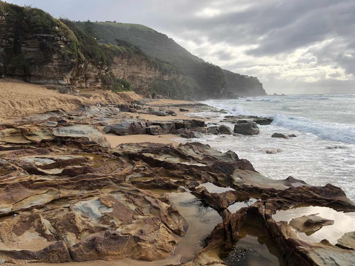
Anyone seen the north end of Stanwell Park Beach lately? Well, it’s mostly gone. The photo below shows rocks that most people have never seen before as the beach was lowered 3-4 m, if not more, in places last month. The same thing happened at...


Anyone seen the north end of Stanwell Park Beach lately? Well, it’s mostly gone. The photo below shows rocks that most people have never seen before as the beach was lowered 3-4 m, if not more, in places last month. The same thing happened at Coalcliff. I’m not sure about other beaches because I don’t get out much, but there’s no doubt there’s been some pretty significant changes along our coast this summer.
Much of this is due to the La Nina weather pattern and the increase in storms and large swell that it brings, which I wrote about a few issues ago. Tropical cyclone waves in early January eroded the beaches and then we had what seemed like the longest big southerly swell ever (a week!) in early February that really did the damage to Stanwell Park and Coalcliff. However, there’s so much geologic control along our coastline that every beach reacts differently to erosion depending on wave direction, how long the beach is and which direction it faces.
A good question is where does all the sand go when beaches erode? Some of it gets dumped offshore where it will eventually return to the beach under the action of normal wave conditions. Some of it gets shifted to the opposite end of the beach. Sometimes beaches recover quickly in months, but sometimes it can take years. It’s really hard to know without a long-term data monitoring system. But generally beaches will fully recover – or do they?
Digital Earth Australia (DEA) Coastlines is a free online dataset created by Geoscience Australia that uses satellite data and some state-of-the-art coastal remote sensing technology to map the typical location of beach shorelines for each year since 1988. It’s accurate to within a few metres and allows us to see trends of overall beach erosion or growth that may be examined over the past three decades at least.
What it shows is that most beaches have been relatively stable over the years, but some, like Coalcliff and McCauley’s, seem to be narrowing. Others, like Wombarra and Sharkey’s, are growing.
What does it all mean? Not much … yet. Thirty years is not a long time in the grand scheme of things, but it does show that it’s perfectly normal for beaches to change dramatically from year to year.
To see what your favourite beach is doing, go to maps.dea.ga.gov.au and start exploring.


