Thunderstorm 101: The science of storms explained
Part 1 in the science of storms, by Ross McLean of Helensburgh

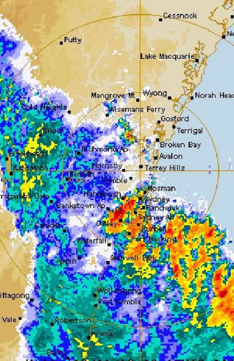
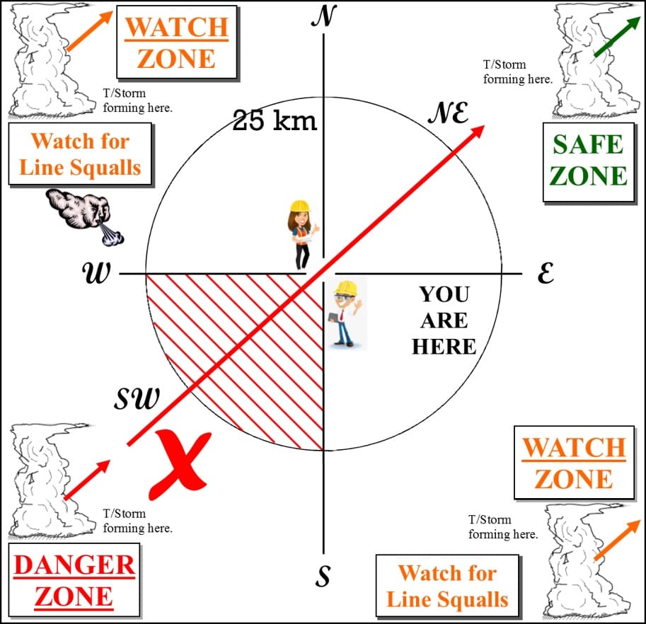
Southern hemisphere thunderstorms in temperate zones mostly come from the south-west and travel to the north-east.
Gaspard Gustave de Coriolis, an 18th century French engineer and mathematician, came up with the idea that rotating objects travelling on a rotating surface (the earth) would tend to move to the right or left depending on which hemisphere they were in – a theory known as Coriolis force.
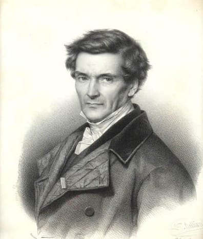
Gaspard Gustave de Coriolis was the French engineer behind the theory known as Coriolis force
The Science Part
Coriolis force caused by Earth’s rotation (west to east) is responsible for air masses being pulled to the right (clockwise) in the northern hemisphere and to the left (anti-clockwise) in the southern hemisphere.
This action is responsible for the direction of air-flow entering a low-pressure system or leaving a high-pressure system. However, when a cyclone crosses the equator, it becomes unpredictable because it is rotating in the wrong direction for its new hemisphere.
The result of all this is that thunderstorms, being acted upon by the jet stream and Coriolis force, will tend to move from the south-west to north-east in southern hemisphere temperate zones.
Thunderstorms do not travel from south-east to north-west, as some people believe happened in Sydney in 2000. That is an impossibility due to the jet stream on the top of thunderstorms pushing them east.
Formation
According to the Bureau of Meteorology (BOM): “Thunderstorms develop when warm, humid air near the ground receives an initial upward push from converging surface winds and rises rapidly in an unstable atmosphere.”
All thunderstorms contain lightning, they occur singly, in clusters or in lines. Thus, it is possible for several thunderstorms to affect one location in the course of a few hours. Some of the most severe weather occurs when a single thunderstorm forms a cluster and continues to affect a location for an extended period of time, for example the Brisbane floods.
What are the warning signs that the weather is deteriorating?
Watch out for fractocumulus clouds – ill-defined clouds in the first or last stage of condensation and representing the tops of small, low atmospheric waves due to rapid winds near the surface of the ocean or land. Dissipating, small convective clouds, such as cumulus humilis and mediocris, often transform into fractocumulus.
When you see fractocumulus clouds that are concave on the underside, like a frowny face, the weather at that location is deteriorating. Once the bad weather has passed the clouds will change, and you will see fractocumulus clouds with a convex underside, like a smiley face.
Keep in mind that thunderstorms are thousands of feet/metres high; some people will argue that thunderstorms always turn to follow their valley, although the valley may be just a few hundred feet deep. This is more likely a squall or rain bands, not a thunderstorm.
Next time we will look at the dangers associated with thunderstorms.
Look out for part 2 in the science of storms series in June
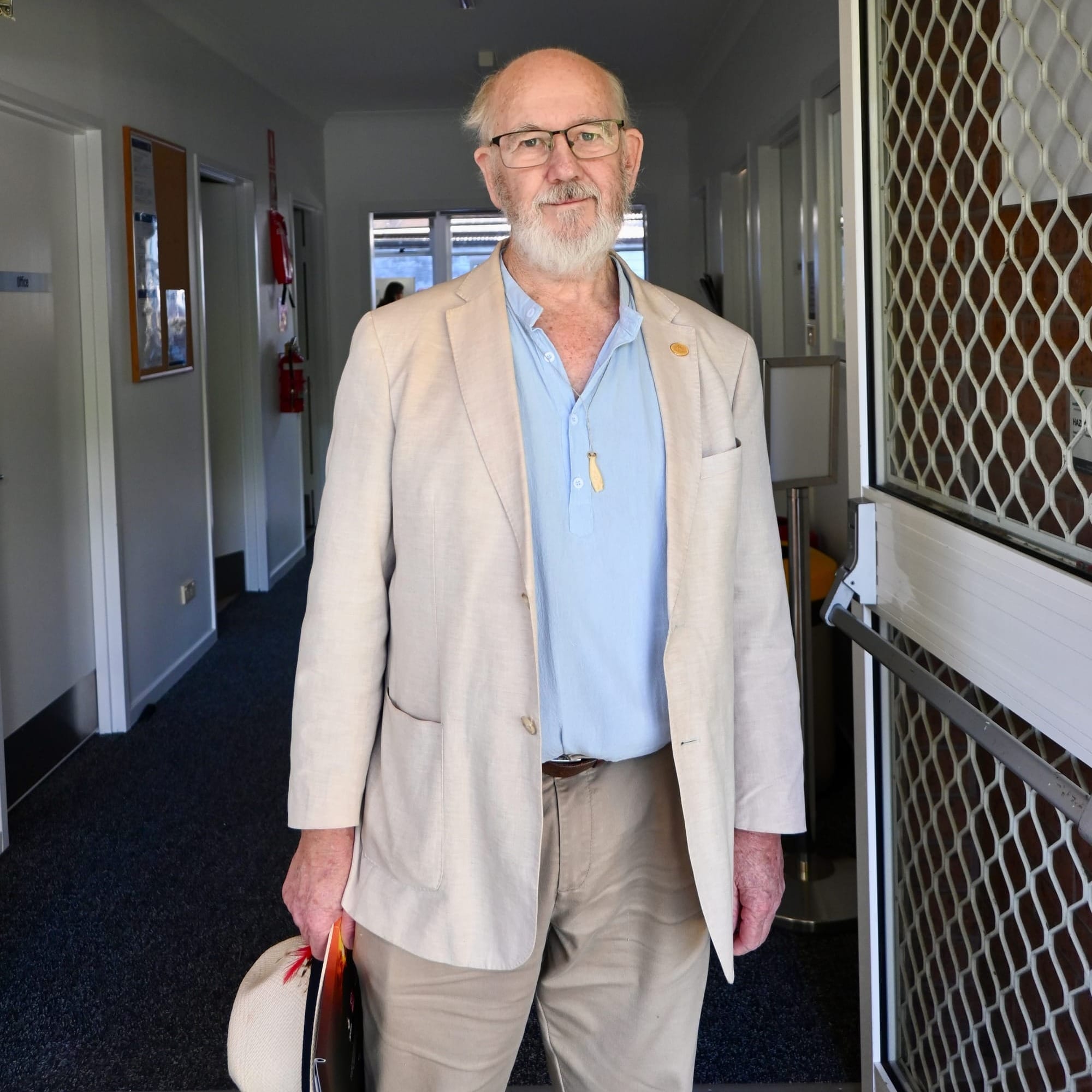
About the writer
Ross McLean has spent over 40 years observing and recording thunderstorms around the world from Australia to South Africa and the US. He spent one and a half years travelling in a Tall Ship around the planet, along the east coast of Australia, New Zealand, Mauritius, South Africa, and the Caribbean to the US.
Arriving in the US, and becoming an instructor with the Annapolis Sailing School, Ross learnt that thunderstorms in the US travelled in directions 90 degrees opposed to those he had observed in the southern hemisphere. This was due to the Coriolis effect, named after the French scientist who had first proposed it.
During his time in the US, Ross worked with members of the National Weather Service (NWS), which routinely tracked and monitored tornado-bearing severe thunderstorms. Using his model that thunderstorms travel along a predetermined path, the NWS storm chasers were able to more accurately place recording equipment to collect data on tornados and other aspects of severe thunderstorms.
On returning to Australia, Ross has been available to talk to civic groups such as Lions Clubs, Rotary, RSL and Probus groups, and occasionally lecturing on thunderstorms to his peers at NSW TAFE’s maritime studies. Ross is a master class 4 captain with a square rig endorsement.
Ross has an engineering diploma from UTS, DipEng (hons). While engineering is his full-time profession, (don’t quit your day job until you’re famous), he is happiest when at the helm of a Tall Ship or watching the vagaries of weather.
Ross is also a former president of the Wooden Boat Association NSW.