

Big bang theory: How well do you know your thunderstorms?
Part 3 in the thunderstorm 101 series by Ross McLean shows what might be heading toward our coastal zone from time to time

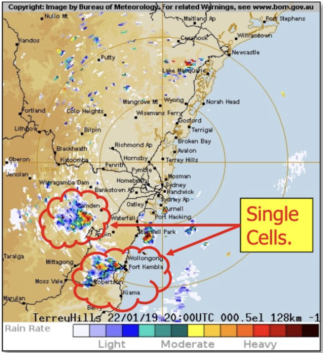
SINGLE CELL (ISOLATED) THUNDERSTORMS
This type of storm, formed by warm, rising moist air, can be non-severe to severe.
A typical thunderstorm is up to 15 miles in diameter and lasts an average of 30 minutes to an hour. Despite their small size, all thunderstorms are dangerous. Of the estimated 100,000 thunderstorms that occur each year in Australia alone, about 10 percent are classified as severe.
Once formed, they travel over land and dissipate fairly quickly, unless the surrounding air becomes unstable enough to propagate more.
SUPERCELL THUNDERSTORMS
All supercell thunderstorms are severe, and once formed, they can cause an enormous area of damage. These are most likely to have severe rotation, and thus cause tornadoes and/or waterspouts.
A supercell is a long-lived and a highly organised storm feeding off an updraft that is tilted and/or rotating. This rotating updraft – as large as 16 kilometres in diameter and up to 50,000 feet tall – can be present as much as 20 to 60 minutes before tornadoes or waterspouts form.
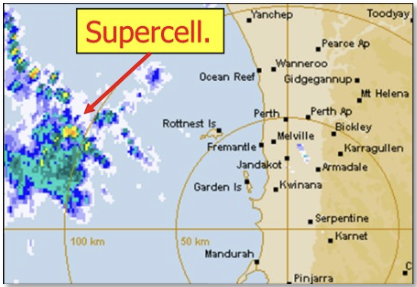
Supercells are often isolated from other thunderstorms and can dominate weather up to 32 kilometers (20 miles) away. They tend to last from two to four hours.
The hail from these storms can destroy roofs of almost any material, as well as having massive wind strengths in their downdrafts.
Supercells can produce hailstones averaging as wide as 50mm, with average winds of more than 110 km/h). Their tornadoes can be as strong as strong as EF3 to EF5 intensity (if wind shear and atmospheric instability are able to support the development of stronger tornadoes), there is often flooding, frequent-to-continuous lightning and very heavy rain.
Many tornado outbreaks come from supercells associated with clusters. Large supercells may spawn multiple long-tracked and deadly tornadoes, with notable examples in the 2011 Super Outbreak in the US.
PYRO THUNDERSTORMS
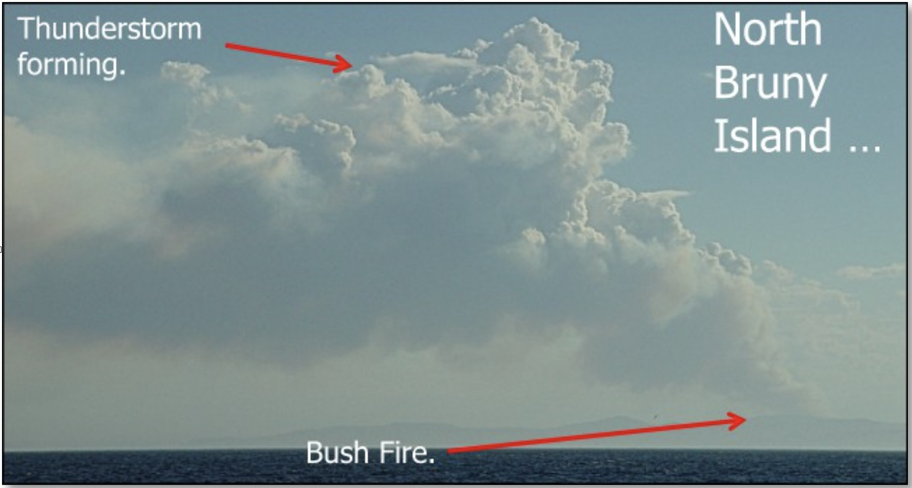
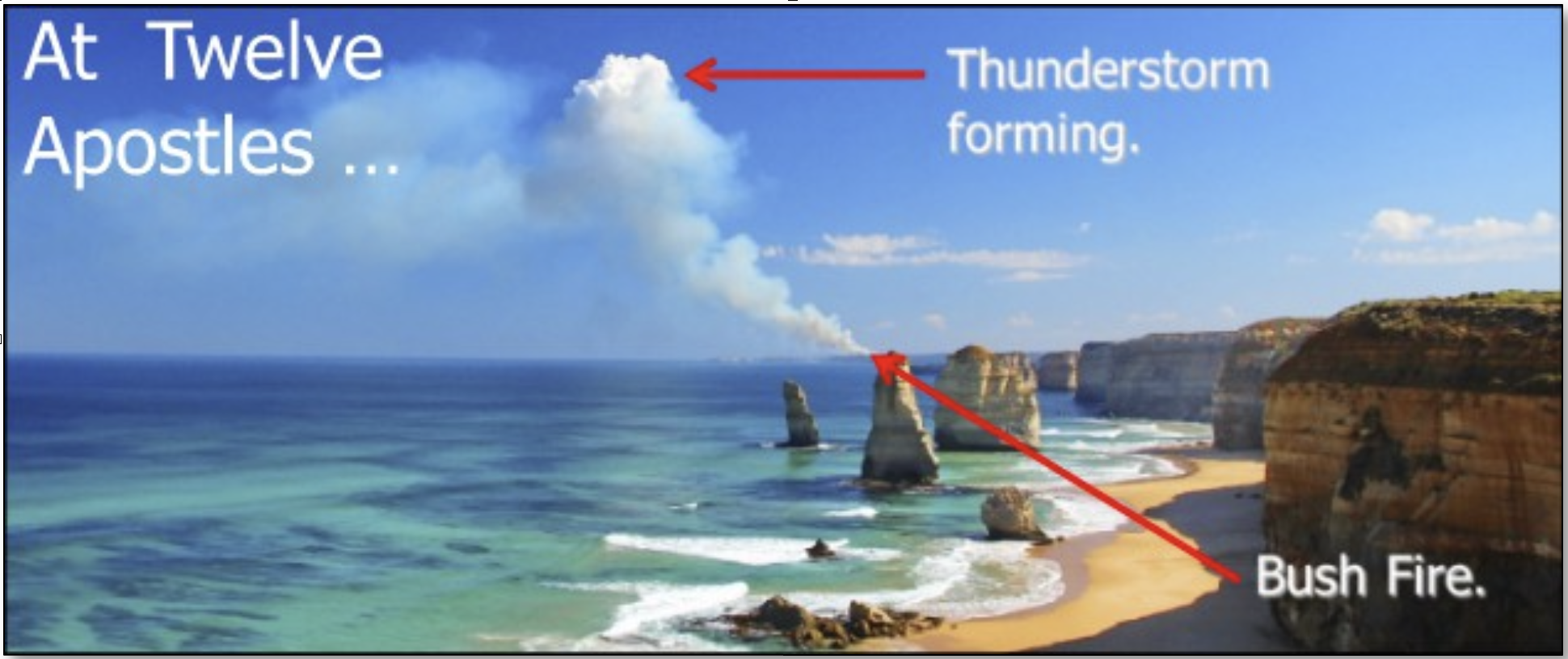
As the name suggests, these fellows are created by the rising air from fires, most often bushfires in Australia, as seen beyond the Twelve Apostles, Victoria and over Bruny Island in Tasmania.
This Bruny Island bushfire (above) was photographed from STV Windeward Bound as we approached Hobart. The thunderstorm developed very rapidly and travelled away from the island in a north-easterly direction behind us once fully formed.
While we lost sight of it after the roll cloud passed overhead, we could see quite clearly the lightning activity in the storm as it travelled eastward. What wind we did receive was coming from the southerly side of a supercell thunderstorm that passed by Mount Wellington, and (it was said by some observers the next day), swung round from the northwest towards the southeast to clobber the Wooden Boat Festival.
Certainly, it filled in over Hobart, and there may well have been squalls accompanying it (from our more unobstructed vantage point on STV Windeward Bound). Meanwhile, the supercell continued on its merry way towards the northeast as it should, governed by our two friends Mr Jet Stream and Mr Coriolis.
THE THUNDERSTORM SPECTRUM
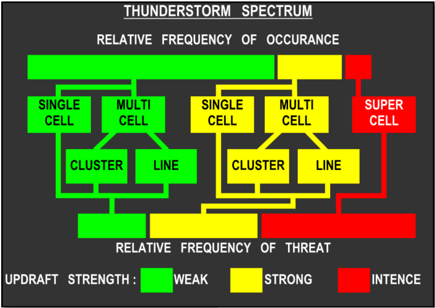
This spectrum describes the level of occurrence and severity of thunderstorms. This is measured from weak to strong and then intense thunderstorms.
As you can see from the graph, single cell, multi cell, cluster and line are fairly common. The supercell is not so common but very intense in nature.
Perhaps we had better have a bit more science again, just to put things in perspective a bit …
MORE SCIENCE – MAMMATUS CLOUDS
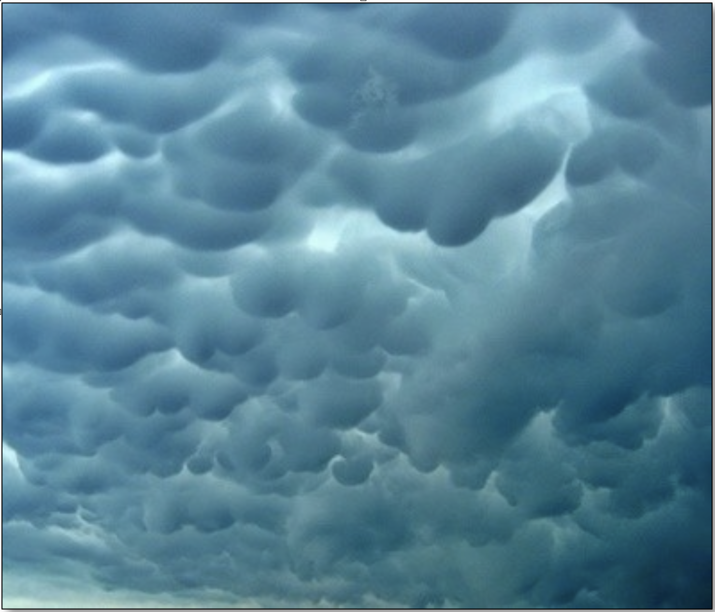
Mammatus (Mamma or Mammatocumulus) are bulbous or pillow-like cloud formations extending from beneath the anvil of a thunderstorm. These clouds form as cold air in the anvil region of a storm sinks into warmer air beneath it.
Mammatus are most apparent when they are lit from one side or below and are therefore at their most impressive near sunset or shortly after sunrise when the sun is low in the sky. Mammatus are not exclusive to supercells and can be associated with developed thunderstorms and cumulonimbus.
In the next part we will look at the FACTS & FICTION about Thunderstorms. How much do you know?
About the writer
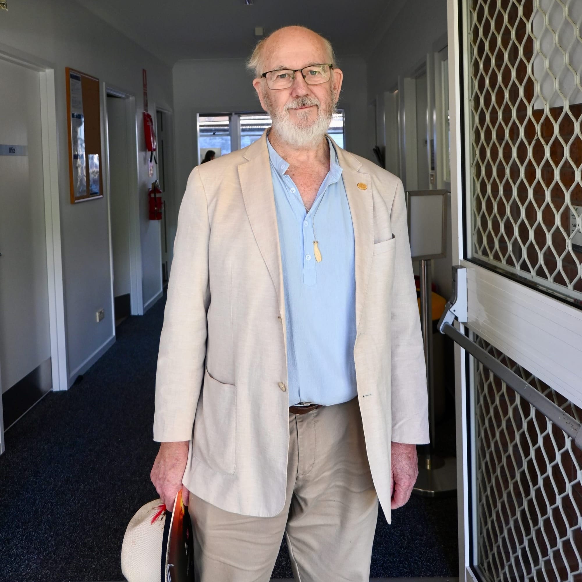
Ross McLean has spent more than 40 years observing and recording thunderstorms everywhere from Australia to Africa and America. He travelled the world in a tall ship and been a sailing instructor in the US. Ross is a master class 4 captain with a square rig endorsement, and a former president of the Wooden Boat Association NSW. While engineering is his full-time profession, he is happiest at the helm of a tall ship or watching the vagaries of weather.
Read more
Part 1 The Science of Storms Explained and part 2, Thunderstorm 101: Danger signs. Part 4 will be out in August


