

Long, hot summer: Australia anticipates strongest El Niño in recorded history
Here's why the NSW coast is braced for a very hot summer and the SES is warning of a volatile storm season
Australia is bracing for its warmest summer in decades. This alarming outlook has emergency services preparing for dangerous fire conditions, and concerned about the health impacts of extreme heat on vulnerable communities.
Climate models are suggesting that sea surface temperatures in the central Pacific could reach 3.6°C above the regional average during an El Niño event that has been described as “unprecedented”.
Until now, the largest anomaly ever recorded was around 2.75°C back in 2015-16. The difference may not sound like much, but consider how much energy it takes to heat a jug of water by just a few degrees. Now imagine heating an area of ocean stretching across tens of thousands of kilometres.
A difference of 0.8°C represents a huge amount of additional heat stored in the ocean, and Australia is already feeling the effects on our weather system.
Our country has been experiencing increased temperatures since September, and these climatic variations are expected to strengthen through November, then peak during the summer months. Understanding what this means for our region and for Australia depends on comprehending climate warning systems and the anomalies that trigger alarm.
Understanding ENSO
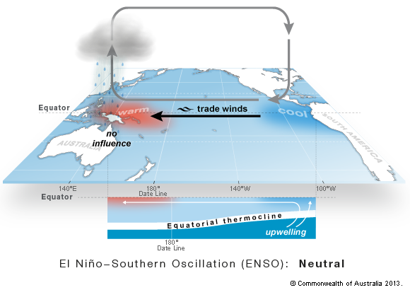
Perhaps you’ve heard the name. The “El Niño-Southern Oscillation”, affectionately known as ENSO, is a global weather phenomenon that causes year to year variations in the atmosphere over the Pacific Ocean.
Under normal conditions, there is a difference in atmospheric pressure between the western (low pressure) and eastern (high pressure) Pacific. Trade winds travel from high to low pressure, pushing warm water west and forcing nutrient-rich cold water up from the deep to replace it. This pattern of ocean circulation is profoundly affected by both phases of the ENSO climate cycle.
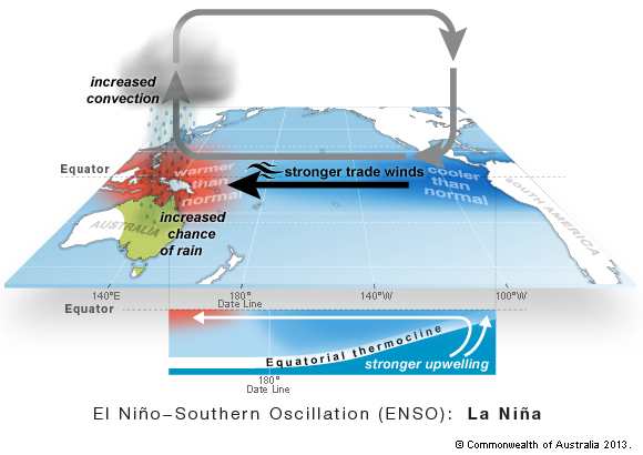
During a La Niña event, the difference in atmospheric pressure between the west and east Pacific increases, causing more warm water to pool in the west. As more warm water evaporates into the atmosphere, Australia experiences increased rainfall and flooding.
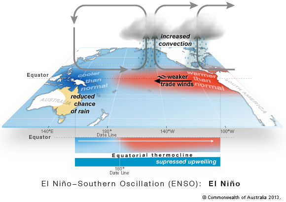
On the other hand, El Niño decreases the pressure difference between the west and east Pacific, disrupting ocean currents and allowing warm water to spread out eastwards. You might think this would make Australia’s weather cooler, but it does quite the opposite!
Without the warm, moist air that normally moves towards Australia, rainfall declines. Less rainfall and fewer clouds mean more sunshine and hotter, drier conditions. Extreme heat can facilitate droughts and bushfires while putting pressure of coastal ecosystems.
What to expect in the Illawarra
The Australian Bureau of Meteorology has advised that this El Niño event will increase average temperatures on the NSW coast. Although it is too early to reliably predict what summer will be like, we know that El Niño conditions increase the risk of heatwaves and fire weather. In addition, dry periods can be interrupted by intense downpours that cause flash flooding.
NSW SES is urging Illawarra residents to prepare for a volatile storm season, warning that this El Niño event may bring intense damaging winds, rainfall, large hail and flash flooding to the NSW coast.
The Minister for Emergency Services, Jihad Dib, has stressed the importance of taking practical steps now for disaster readiness: “Preparation is one of the most effective ways people can protect their homes and their families. Please download the Hazards Near Me app, set a watch zone and stay across weather alerts and warnings”.
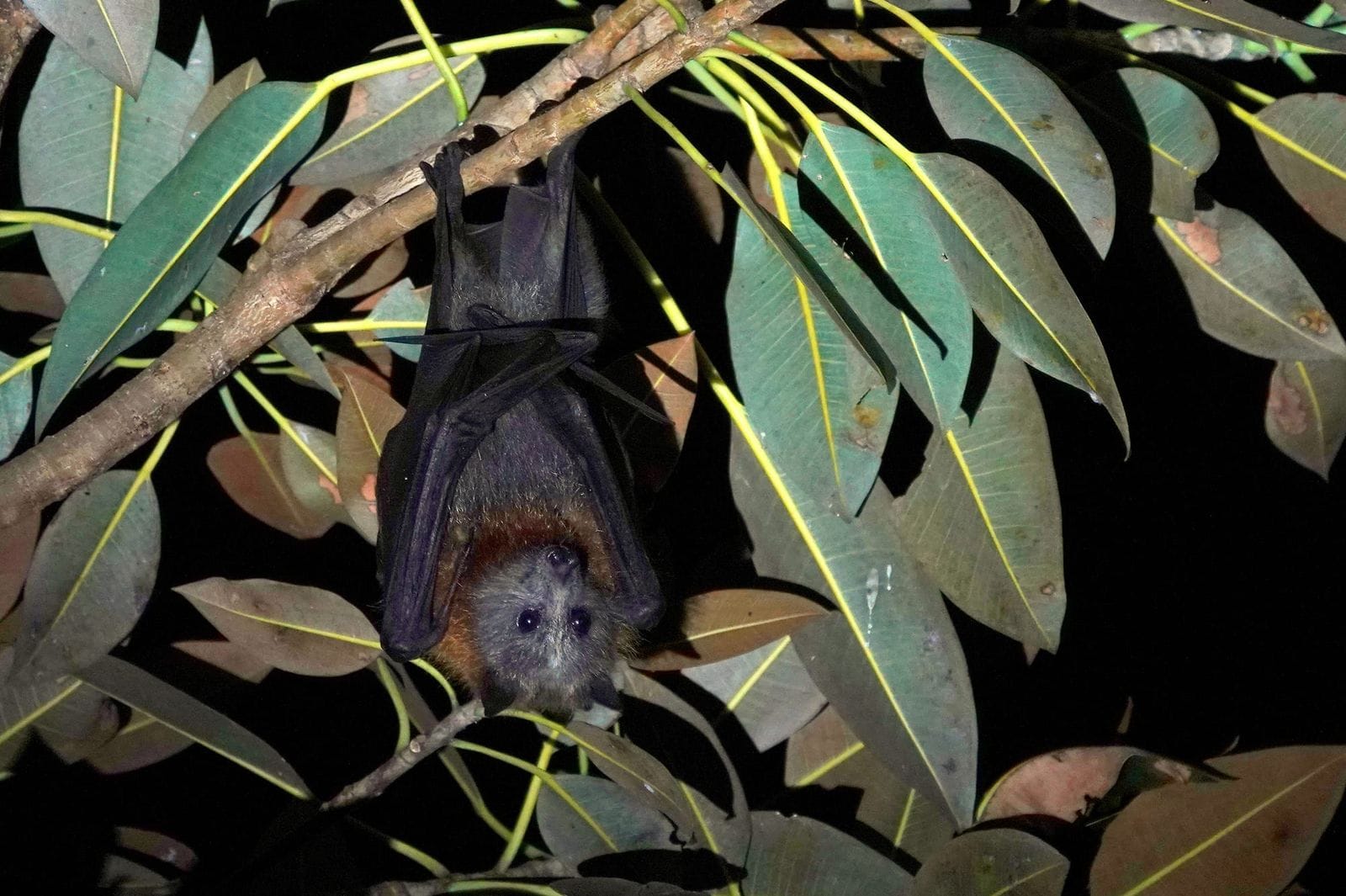
Apart from the obvious threat of bushfires, our local environment will also be tested by extreme heat.
Emerita Professor Lesley Hughes, a councillor with the Climate Council of Australia, said: “Terrestrial Australian plants and animals are generally fairly well adapted for hot and dry conditions but this varies a lot depending on the species. Species such as flying foxes, for example, are particularly vulnerable to extreme heat.
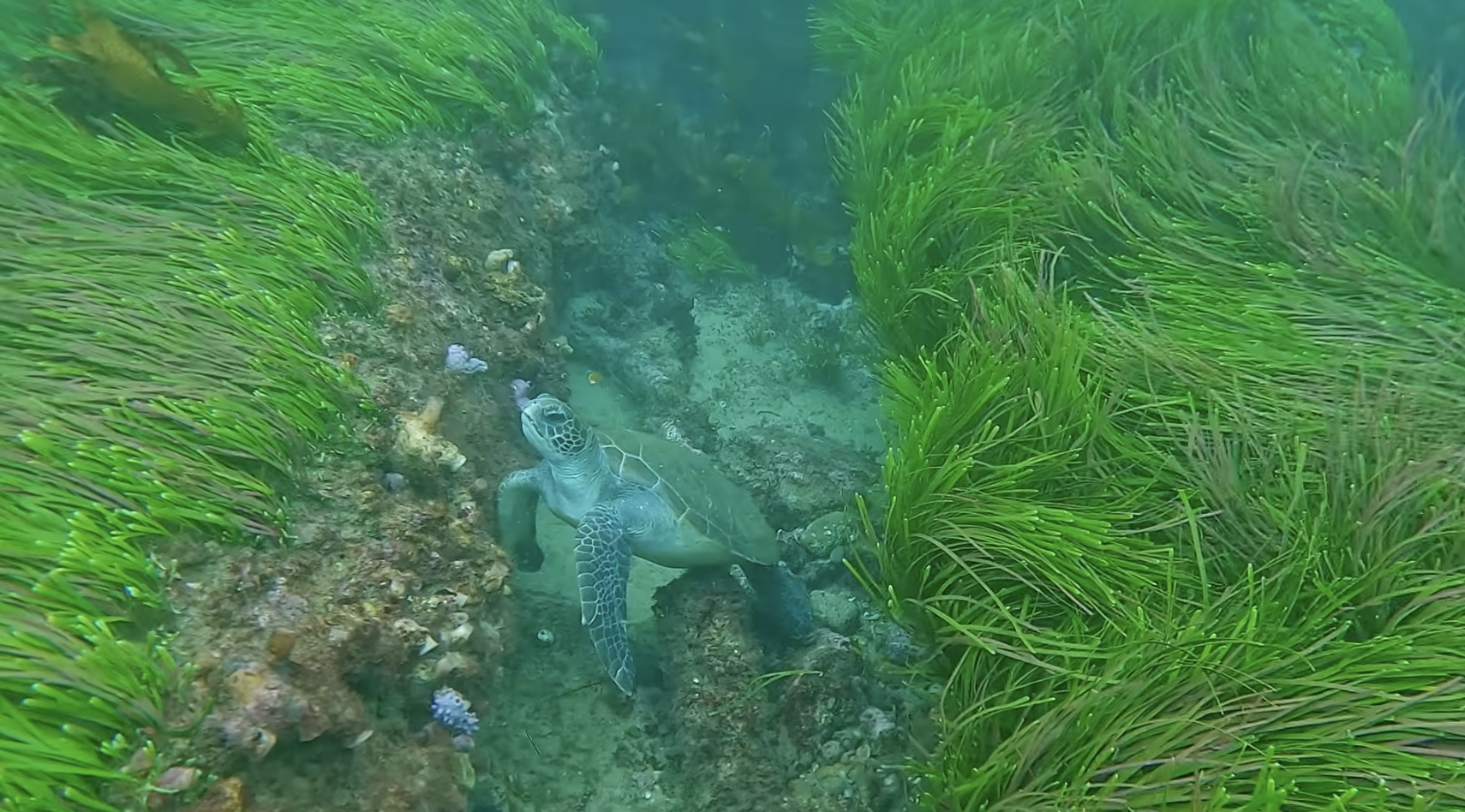
"Marine species are currently experiencing record high sea temperatures, and in the past, we’ve seen major impacts of underwater heatwaves on ecosystems such as coral reefs and kelp forests.”
A climate story
ENSO is a normal variation in the earth’s climate, so why should we be worried about another phase in this natural and repetitive cycle?
Professor Lesley Hughes explains: “This El Niño is being imposed on a background warming trend caused by increasing greenhouse gases being emitted, largely from the burning of fossil fuels.”
In a statement for the Climate Council, Adjunct Professor Andrew Watkins said: “It’s important to understand that this El Niño is happening in an Australia that’s significantly hotter than 120 years ago, with the highest levels of carbon dioxide in the atmosphere in 800,000 years.”
The double whammy of climate pollution and El Niño variations will hit the country hard, putting pressure on our natural environments, infrastructure and communities. Global warming is also increasing the frequency of multi-year ENSO events with prolonged El Niño phases.

Professor Lesley Hughes said the severity depends on how long the hot conditions go for.
“At this stage it’s not known how long these conditions will last, over and above the 'normal' summer heat,” she said.
Unfortunately, there is very little we can do to minimise the effects of this unfolding super El Niño on our region without scaling climate action. This is one reason citizens are mobilising to stop the mining, export and burning of fossil fuels both within Australia and overseas.
This event should and will serve as both a wakeup call, and a call to action. How will you respond?
Stay up to date
The Hazards Near Me app, Hazard Watch, and the NSW SES website provide real-time updates on dangerous weather conditions and regional alerts.
If you want to learn more about local climate action in the Illawarra and how to get involved, visit the Illawarra Environment Network.
Sources: The Climate Brink, NOAA, BOM, NSW SES, Nature, Climate Council and UNSWorks.


