Capturing storm clouds: Move quickly and snap before the deluge
Keeping an eye on your exposure - yours as well as your camera's - can pay off when photographing towering cumulus
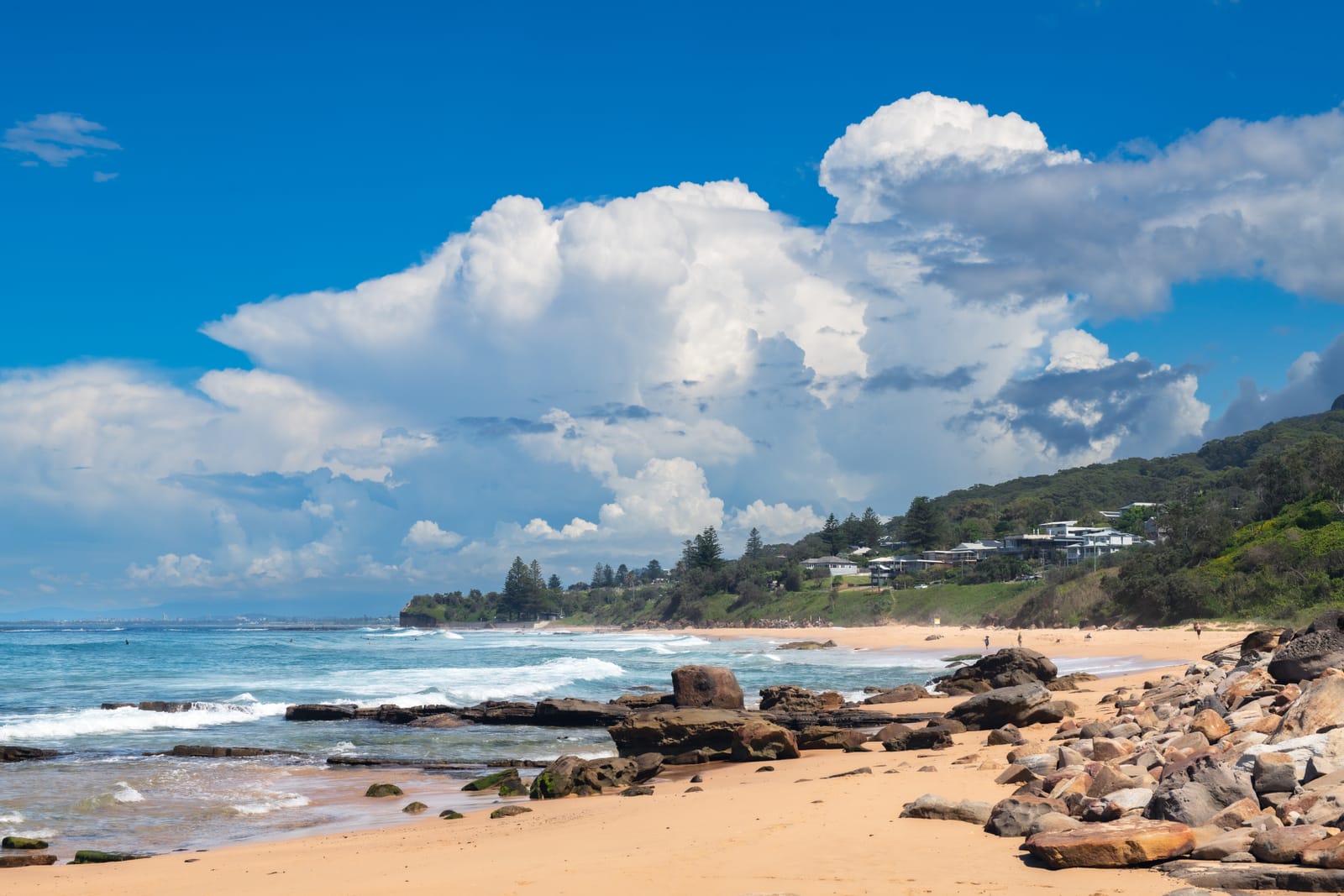
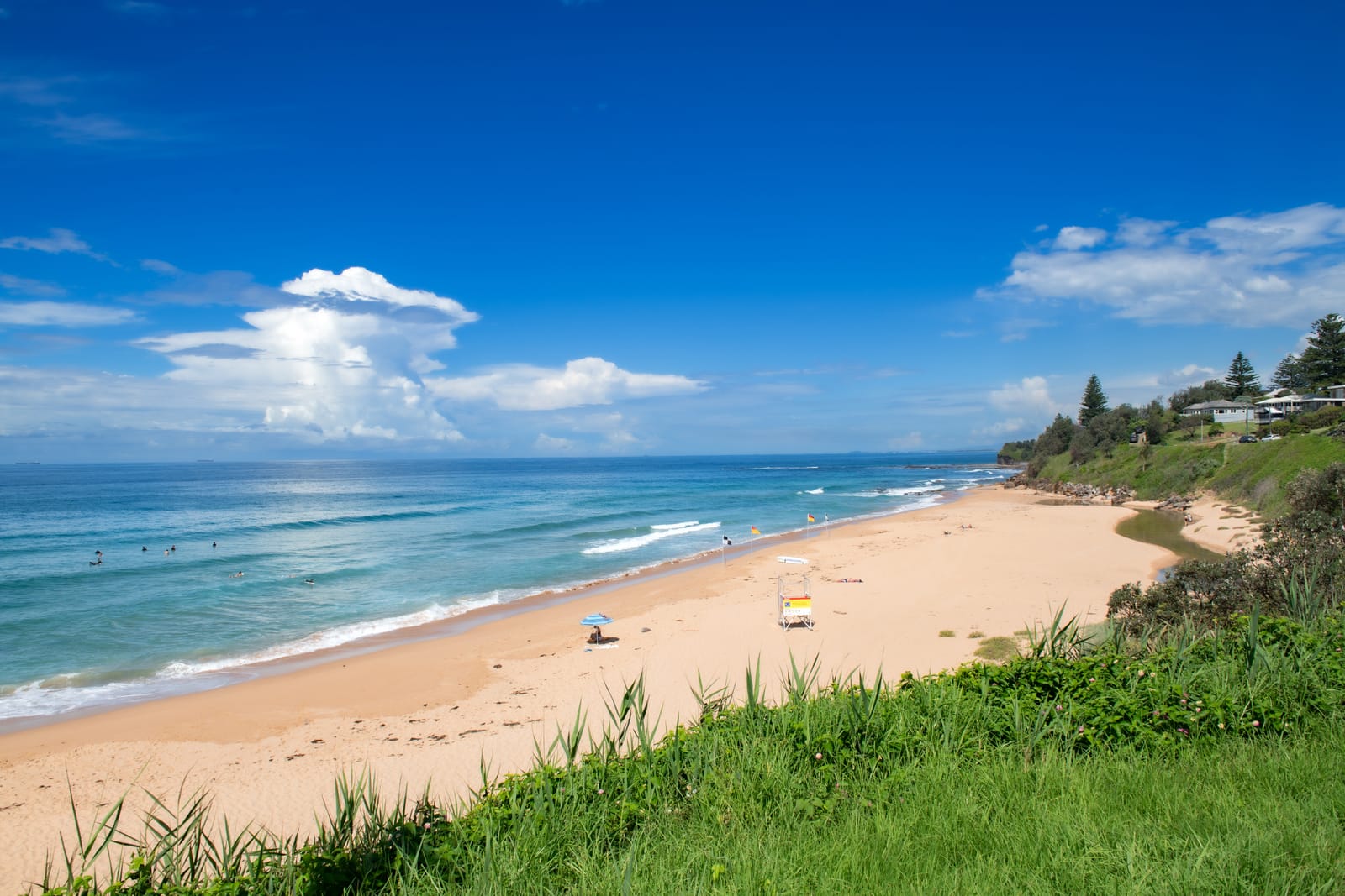
I took these photographs at Scarborough Beach in Wombarra, one of my favourite Illawarra beaches. It was a beautiful, warm day, but a little too humid for my liking.
On arrival, there were minimal clouds in the sky, but within 30 minutes, towering cumulus clouds began rising on the eastern horizon. These incredible formations are among the most spectacular cloud types and are highly photogenic, adding something special to any landscape scene.
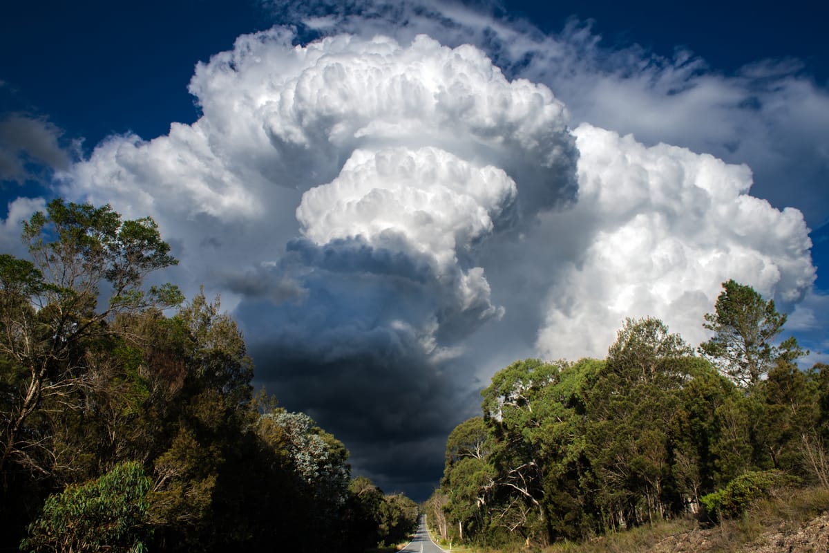
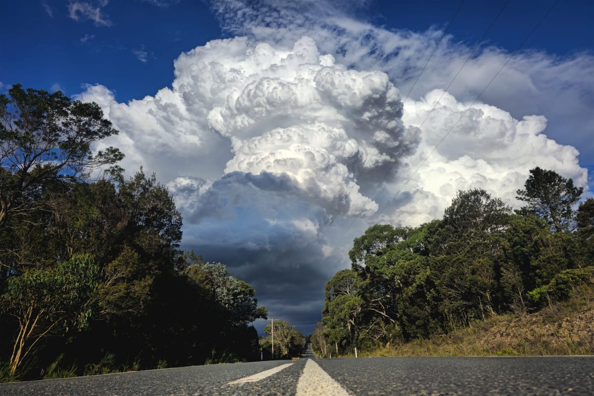
Cumulus congestus, also referred to as towering cumulus or Cu Con, are dense clouds that expand rapidly, particularly in vertical extent, often reaching heights of more than 6000 metres. They are an indication of atmospheric instability and almost always evolve into cumulonimbus storm clouds, which can produce severe weather conditions, including heavy rain and possible hail.
On this occasion, those signs were accurate, with storms and heavy rain developing shortly after these photos were captured.
Cumulus congestus clouds have been developing frequently over the summer period and well into autumn this year, particularly over the past three weeks, which is a delight for a weather-chasing landscape photographer like myself.
To photograph these clouds:
- Look out for them on warm, humid days.
- They often appear in the afternoon after the sun has heated the ground, causing thermal uplift.
- Summer is typically the best time to see them but keep an eye out in late spring and early autumn as well.
- They often develop over mountain ranges, such as the Illawarra escarpment.
- They rise very quickly, so try to get to a lookout or beach promptly to capture them.
- Keep in mind that when they build vertically, they will probably bring a localised storm and potentially wild weather.
- A wide-angle lens, such as a 16-35mm or 24-70mm, is ideal for capturing the full extent of the clouds while incorporating the surrounding landscape.
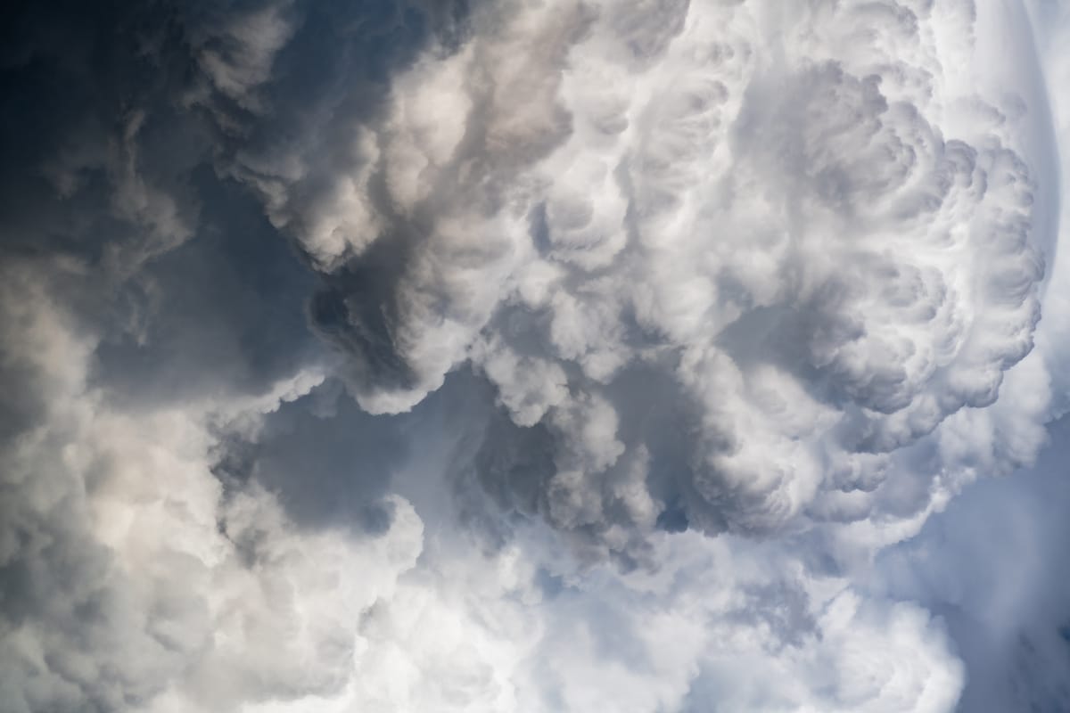
- That said, a zoom lens of 200mm or greater can produce dramatic shots of specific sections within the cloud.
- Keep an eye on your exposure metering and avoid overexposing your shots as the bright whites of the cloud can easily blow out and ruin the image.
- I normally frame my shots in a landscape orientation, but due to the vertical nature of these clouds, it’s well worth capturing some images in portrait orientation as well.